Sacramento International Airport (SMF)
Orientation and Maps
(Sacramento, California (CA), USA)
Capital of California and featuring a population of more than 400,000 people, the city of Sacramento is known for its history, including the gold rush days many years ago. Sacramento features two prominent universities, an appealing harbor area, and countless riverfront attractions.
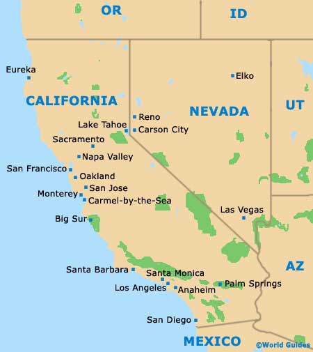
Standing off the I-5 interstate, the Sacramento International Airport (SMF) lies extremely close to the city center, being located on the northern side. Sacramento is approximately 90 miles / 145 km to the east of San Francisco and the two cities are connected by regular greyhound buses. The Greyhound bus terminal can be found along 7th Street.
Sacramento International Airport (SMF) Maps: Important City Districts
Operating a local city bus service, Sacramento Regional Transit is also responsible for a popular light-rail system, which links many places of interest. Close to the downtown district, the Amtrak train station is situated along 5th street and features trains to the cities of Oakland and Reno, amongst other locations.
Close to the river and featuring many listed historical buildings and structures, Old Sacramento is a great place to start your visit. This part of the city of home to the visitors center, on 2nd Street, where you will find plenty of free maps and advice to help you get the most out of your visit. Nearby, paddle boats offer interesting guided tours of the area, along the Sacramento River.
The city's thriving arts scene is concentrated around the Uptown area, otherwise known as North Sacramento, while the Capitol Area is also worth a look and best known for its spacious park and attractive Victorian buildings.
USA Map

California Map

Sacramento Map


